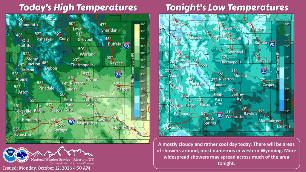
A Winter Weather Advisory is in effect until 6 a.m. MDT Wednesday for the Wind River Mountains in Wyoming and the Western Uinta Mountains in Utah, with up to 12 to 14 inches of snow possible at higher elevations.
Travel could be difficult, especially in the backcountry and on high mountain routes.
Wyoming: Wind River Mountains

The National Weather Service in Riverton issued the advisory at 1:10 p.m. MDT Monday for the Wind River Mountains West and East.
Below 9,000 feet: a coating to 3 inches.
Above 9,000 feet: 3 to 12 inches.
South Pass: a coating to an inch, mainly on grassy surfaces. Commutes across South Pass may still be affected.
NWS Riverton says rounds of precipitation will continue for the next few days.

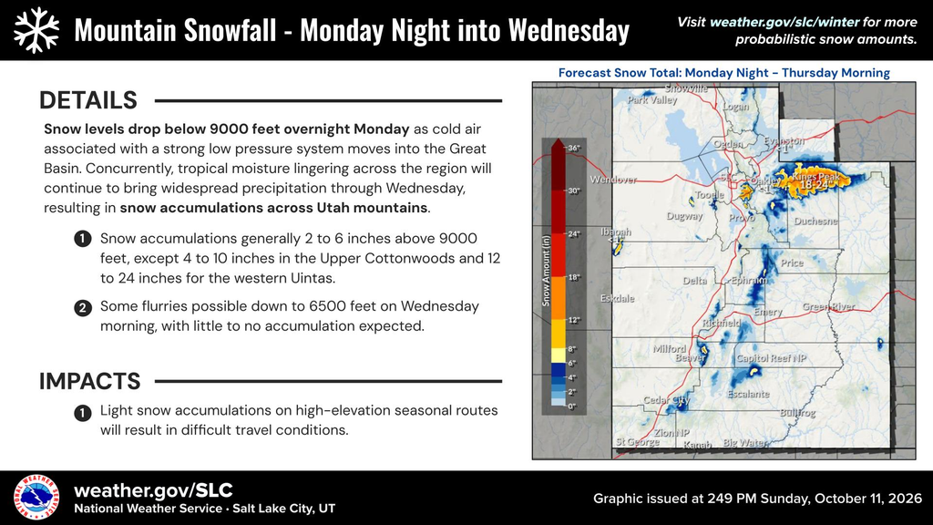
Utah: Western Uinta Mountains
The National Weather Service in Salt Lake City issued its advisory at 1:51 p.m. MDT Monday.
Additional snow of 8 to 14 inches is possible, especially above 9,000 feet.
The advisory includes Mirror Lake Highway and Moon Lake.
Traction law restrictions may be enacted.
Seasonal roads such as Bald Mountain Pass remain open for now. They may pose a significant risk to under-prepared travelers, so expect periods of accumulating snow on high routes.
Safety Reminders
Slow down and use caution while traveling.
Check road conditions before you go. In Wyoming, call 511. In Utah, visit UDOT Traffic.
Carry extra clothing, food, water and a charged phone if heading into the backcountry.
For live updates, follow NWS Riverton and NWS Salt Lake City on X.